Sivu on muuttanut uuteen osoitteeseen

DANCES WITH KANGAROOS

Tuesday, February 1, 2011

Kings Canyon

The next day we drove to Kings Canyon. Kings Canyon is a part of Watarrka National Park. We did a 3-4 hour walk around the top of the Canyon. It was a hot day, and the walk started with a really steep climb that the locals call 'Heart Attack Hill', but it was one of the best walks we did during our trip, if not the best. 

The walls of Kings Canyon are 300 metres high. Needless to say, the views were AMAZING. 


Beehive rock formations called the 'Lost City'. Doesn't look like it belongs on this Earth. 
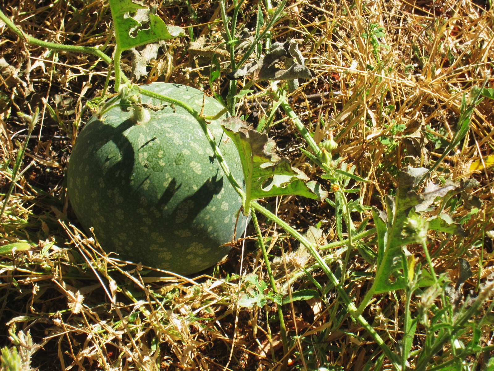

Wild watermelon!

Labels: , , , , , , , , , , , , ,

Monday, January 10, 2011

The Big Red Rock part II

We watched Uluru change color as the sun set.


We drove to the closest free campsite, which was 50 km away. The next morning we got up early to see the sunrise. I think Rohan had some serious difficulties in getting me up before 5 am. The sunrise was gorgeous, but we were on the wrong side of the Rock to get it in the same photo. The nights were really cold.


We started the day with a short ranger guided walk, where the guide showed us some of the sacred sites around Uluru and told us a great deal about the aboriginal culture. The walk was free, and the ranger seemed to know a lot about the aboriginals. There was also longer guided walks available with an aboriginal guide, but they were too expensive for us. 


After that we did the walk around Uluru, about 10 km. It was a hot day and the amount of flies trying to invade our eyes, noses and ears was, well, slightly disturbing!! I'm not exaggerating when I say that at any given minute there was at least 50 flies on me!! Still, it was worth it! We saw some waterholes, aboriginal paintings and carvings, and many sacred places that you weren't allowed to take photos of.


That night we had booked a campsite at the only campground close by, Ayers Rock Resort. It is an overpriced rip-off place, but we needed a shower. Besides, I do think it is a good thing that they are setting some limits on the tourism infrastructure and protecting the park. 

Labels: , , , , , , , , , , , , ,

Wednesday, December 22, 2010

Didgeridoo

Before we started heading towards the big red rock, we had to stock up in Alice and while we were there, we wanted to try the didgeridoo. There was an amazing didgeridoo player giving free lessons at a didgeridoo shop. I have to tell you guys, it is much harder than it looks like... But great fun! For me the most difficult part was trying not to laugh when I played it. 


The view of Alice Springs from the lookout on Anzac Hill


Flag of the Northern Territory

A disturbing sign in a public toilet:


At first glance, these headlines in a local newspaper were even more disturbing:


After reading a bit more, you notice that this time kids in fact refer to baby goats. Still, freaked me out.

Labels: , , , , , , , , ,

Tuesday, December 21, 2010

The West MacDonnell Ranges part II

The third day we started heading back to Alice, stopping at some beautiful and interesting spots along the way. 


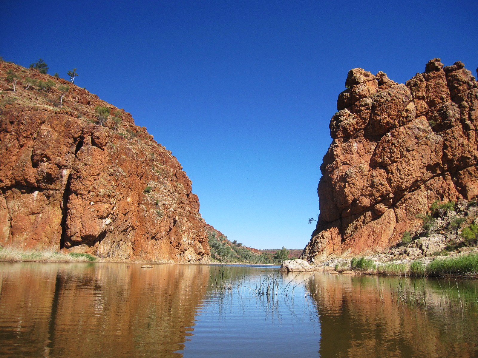
Ellery Creek Big Hole is a big waterhole surrounded with red cliffs and gum trees. 


Ochre Pits is a colourful outcrop of ochre on the banks of a dry river. Aboriginals use ochre for several purposes from painting to medicine. 


We climbed up the Serpentine Gorge and had some stunning panoramic views. Everything around us was so peaceful, with the sunshine flowing into the trees... I think we were without a care in the world.


It is amazing how climbing a hill can give you such perspective to everything. Everybody should do that every now and then.


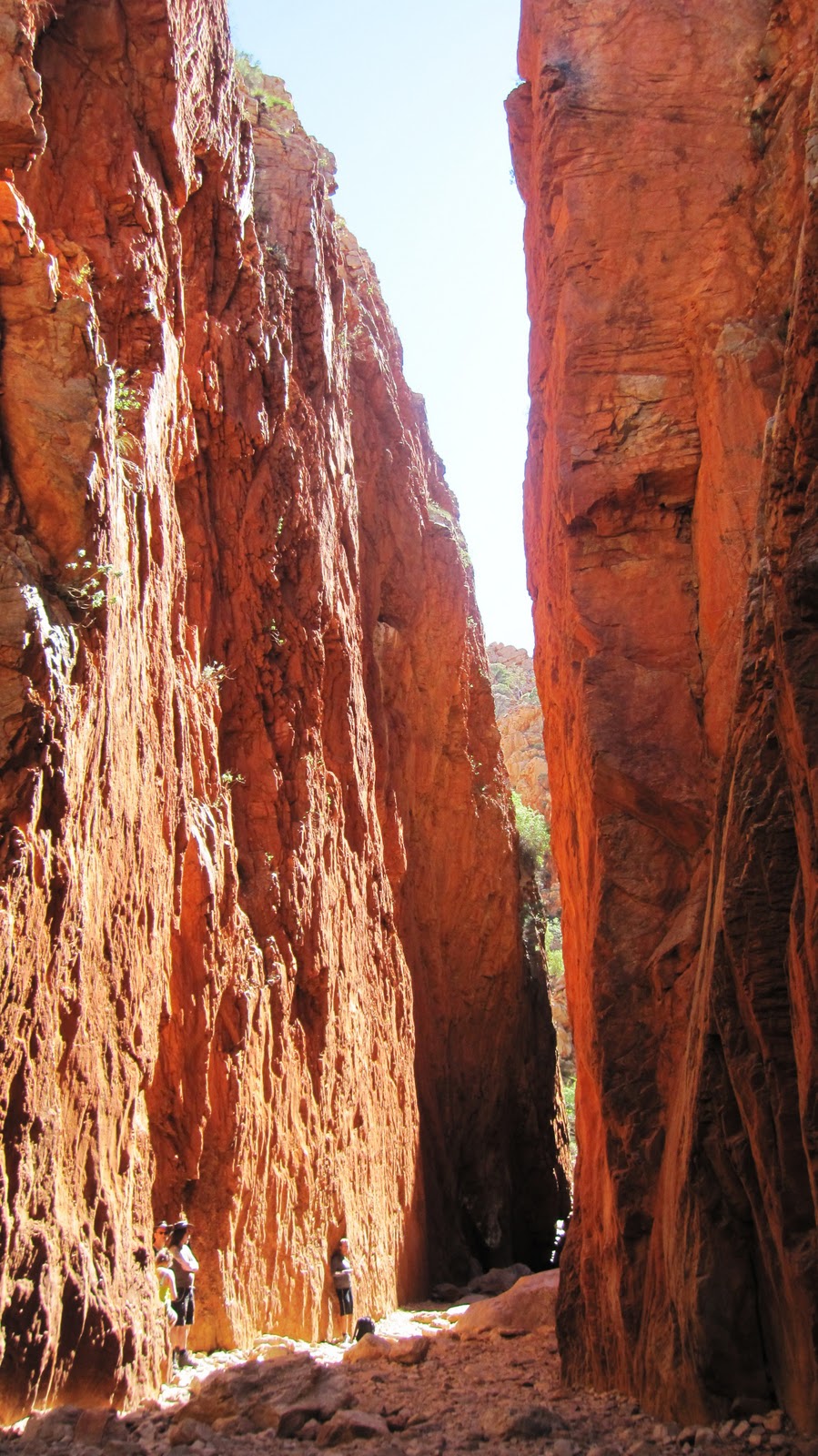
Standley Chasm is a deep red cleft with 80 metres high slopes, formed by floods over millions of years. The walls glow from sunlight. We did a short walk that ended in a sign that said "DO NOT PASS THIS POINT. If you do, you risk serious injury or DEATH.". To Rohan, this kind of sign is apparently an invitation. So up we climbed. And got back alive. 


Simpsons Gap is one of the most prominent gaps in the area. We also saw some black-footed rock wallabies jumping on the cliffs along the walking track. 


The West MacDonnell Ranges are a beautiful, peaceful spot to make long walks and totally empty your mind. 

Look deep into nature, and then you will understand everything better... -Albert Einstein

Labels: , , , , , , , , , , ,

The West MacDonnell Ranges part I

The MacDonnell Ranges are a series of mountain ranges that stretch out for hundreds of kilometres on both sides of Alice Springs. As time was limited, this time we were only going to do the West MacDonnell Ranges. 

The traditional owners of Alice Springs area believe that the ranges were originally giant caterpillars that entered this world through one of the huge gaps in the area. And from far away the mountains do indeed resemble a giant caterpillar. 


The weather had changed since we got to the centre of Australia. In the daytime it was nice and around +25 degrees, but at night the temperature dropped and it got really cold. 


The first night we stayed at a place called Ormiston Gorge. We did a couple of walks around the Gorge. One of them ended at a deep waterhole that we had to swim through, wearing our shoes, and the water was icy cold!


It is easy to imagine why the mountains and the area have such a significant meaning for the aboriginal people. Gorgeous landscapes, beautiful nature and a vast silence around you. Just us and the mountains...


Wild watermelon!

Labels: , , , , , , , , ,

The Red Centre

After 10 days of driving from Cairns we finally reached the Red Centre of Australia. Alice Springs, with only 27,000 people is the unofficial capital of Central Australia and is situated in the geographic centre of Australia. 

Alice Springs is a nice little town, a mix of old-style buildings and modern shopping centres. It is also the aboriginal art capital of Australia, and the streets are full of art shops one after another. For the flocks of tourists there are also tour operators and travel agencies in every corner. 


Approaching Alice we ran into these signs. Alice Springs is a dry zone, and that means you will get a heavy fine for drinking in public or carrying too much alcohol with you. You see, the indigenous Australians in the area (25% of the population in Alice Springs) like the booze a bit too much. So the town is trying to reduce alcohol-related problems with these new laws. For instance, bottle shops don't open until 2 pm and you can only buy cask wine after 6 pm, and only 2 litres per person. But when we visited the local Bottle-O, to us it seemed like the liquor was still flowing among the aboriginals despite the laws. 

But we only did a quick stop in Alice this time and moved on to the West MacDonnell Ranges for a couple of nights. 

Labels: , , , , , , , , , , , , , , , ,

Monday, December 20, 2010

Towards the Centre of Australia

Before arriving in Alice Springs we stopped at a couple of interesting little townships. Wycliffe Well is supposed to be the Roswell of Australia, a UFO village. It is said that UFO sightings are so common there that you are considered unlucky if you stay there and don't see anything. Well, we only did a quick stop and didn't see any aliens. It was basically just a petrol station and not much to see. 


We camped about a 100 km north from Alice Springs that night.


In another small village of Aileron we stopped for photos of these big aboriginal statues.


There was a big friendly kangaroo who gave me kisses.


Soooo CUTE!

Labels: , , , , , , , , , ,

Friday, December 17, 2010

Devil's Marbles

We stopped for Internet, supermarket and laundry in one of Northern Territory's biggest towns, Tennant Creek, with the population of 3,000. I guess there are not many big towns in the Northern Territory. Most of the population is aboriginals.


An hour's drive from Tennant Creek are the Devils Marbles. It is a pile of huge, several metres high, red, round granite boulders that have formed about 1700 million years ago. The site is known as Karlu Karlu for the traditional aboriginal owners. 


It is a very sacred site for the aboriginals. Aboriginal people believe that people from the Dreaming (stories that tell of the journey of Ancestral Beings that created the world) hide in the caves under the rocks. 


"They are real people like us. You can see them. A long time ago I went with my billycan down to the creek here to get some water. One of these secret people came out and started playing with me. I couldn't go away. My mother came and got me, saved me. After that we never camped at this place again, never. They are kind these secret people, but they can make you mad. They can change you into one of them. They can say 'follow me' and you can't go back. It happened like that for my cousin. He disappeared. The old people made a big ceremony, singing the ground and the rocks to make them let my cousin come back. We have lost that song now. We have no song to bring children back." A senior traditional owner

We were lucky, and secret people didn't make us mad. .... Or did they? 

Labels: , , , , , , , , , ,